Duration: 1h 2m | Video: .MP4, 1280×720, 30 fps | Audio: AAC, 48 kHz, 2ch | Size: 716 MB
Genre: eLearning | Language: English
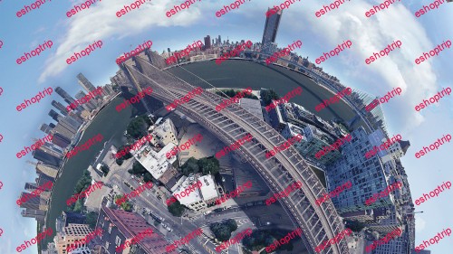
Create an amazing, 360° panorama featuring your favourite city from around the world.
You have probably seen a ‘little planet’ panorama before, stitched together from photos or a 360° camera – but have you seen one from way above the New York skyline or Grand Canyon? What if you could create your own from the comfort of your home, no cameras or drones required?
Join Matt Olsen, Architect and Design Technology Lead, to learn how to combine 3D aerial images from Google Earth into stunning panoramas using Microsoft Image Composite Editor. Best of all – both of these programs are completely free!
Matt will explain, step-by-step, how to:
Position the camera in Google Earth to achieve the best perspective.
Adjust the field of view using a hidden setting to reduce the number of images required and speed up the process of creating your panorama.
Use Microsoft Image Composite Editor to fine-tune the perspective and stitching of the panorama.
In the second half of the class, Matt will show you how to enhance your panorama in Adobe Photoshop, adding a background, adjusting colours, adding light effects and tidying up Google Earth imagery to make the final result really stand out. No previous experience with Photoshop is assumed, and these skills will help you with any kind of photo manipulation you need to do in future too.




Reviews
There are no reviews yet.